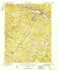
1950 Map of Dillwyn
USGS Topo · Published 1950About this map
The James River corridor and its surrounding Piedmont woodlands define this mid-century landscape, where the Chesapeake and Ohio railway tracks trace the northern riverbank. Significant architectural and historical markers are concentrated here, including the Bremo Mansion and Lower Bremo Mansion near Bremo Bluff, reflecting the region's deep-rooted plantation history. The interior of the county is a dense network of timberlands and rural crossroads, notably anchored by the Cumberland State Forest and recreational waters like Bear Creek Lake and Winston Lake.
Find a feature on this map
114 named features on this map. Tap any name to fly to it.
Don’t see what you’re looking for? This feature index may not catch every label — zoom into the map to look around manually.
Map Details
Editions of this 1950 Dillwyn Map
2 editions found

Other maps of this area

1891 · Palmyra
USGS Topo · 1:125,000

1891 · Farmville
USGS Topo · 1:125,000

1892 · Buckingham
USGS Topo · 1:125,000

1892 · Appomattox
USGS Topo · 1:125,000

1893 · Farmville
USGS Topo · 1:125,000

1895 · Palmyra
USGS Topo · 1:125,000

1897 · Palmyra
USGS Topo · 1:125,000

1929 · Covesville
USGS Topo · 1:62,500

1935 · Covesville
USGS Topo · 1:62,500

1943 · Scottsville
USGS Topo · 1:62,500