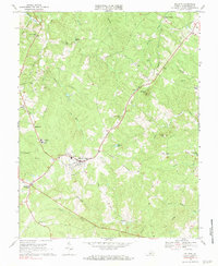
1968 Map of Dillwyn
USGS Topo · Published 1984About this map
The Chesapeake and Ohio railroad corridor serves as the central artery through this portion of Buckingham County, connecting the town of Dillwyn to the rail network at the end of the 1960s. The landscape is characterized by a high density of rural institutions, including the Woodson High Sch and Ellis Sch, alongside numerous community anchors like Mt Olive Ch and Hanes Chapel. These markers, along with family-named sites such as Ayers Cem and Whitlock Cem, offer a detailed view of the social geography in north-central Virginia during this era.
Find a feature on this map
49 named features on this map. Tap any name to fly to it.
Don’t see what you’re looking for? This feature index may not catch every label — zoom into the map to look around manually.
Map Details
Editions of this 1968 Dillwyn Map
3 editions found
Other maps of this area

1891 · Palmyra
USGS Topo · 1:125,000

1891 · Farmville
USGS Topo · 1:125,000

1892 · Buckingham
USGS Topo · 1:125,000

1892 · Appomattox
USGS Topo · 1:125,000

1893 · Farmville
USGS Topo · 1:125,000

1895 · Palmyra
USGS Topo · 1:125,000

1897 · Palmyra
USGS Topo · 1:125,000

1947 · Roanoke
USGS Topo · 1:250,000

1950 · Dillwyn
USGS Topo · 1:62,500

1958 · Farmville
USGS Topo · 1:62,500