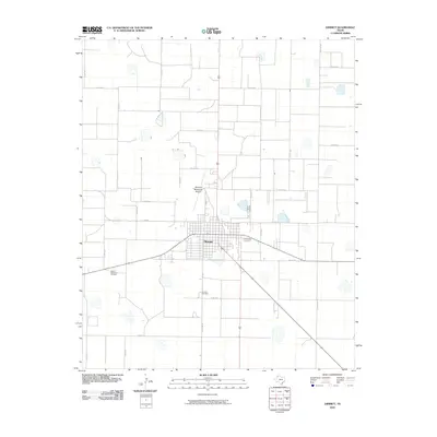
2010 Map of Dimmitt
USGS Topo · Published 2010About this map
Dimmitt serves as the central hub of this High Plains landscape, organized by an extensive grid of section-line roads. The town's layout is clearly defined, with the Dimmitt Municipal Airport situated to the north and two significant burial sites to the south and west. Local family history is centered around the Dimmitt Cemetery, located along Cemetery Rd, and Castro Memorial Gardens on the western edge of town. This survey illustrates the systematic agricultural partitioning of Castro County, where farm-to-market routes like Fm 2392 and Fm 3215 connect the town center to a network of rural county roads. Numerous small depressions and seasonal water features are scattered throughout the surrounding farmland, reflecting the unique playa lake topography characteristic of this part of the Texas Panhandle.
Find a feature on this map
27 named features on this map. Tap any name to fly to it.
Don’t see what you’re looking for? This feature index may not catch every label — zoom into the map to look around manually.
Map Details
Editions of this 2010 Dimmitt Map
This is the sole edition of this map. No revisions or reprints were ever made.
Other maps of this area

1954 · Clovis
USGS Topo · 1:250,000

1958 · Clovis
USGS Topo · 1:250,000

1962 · Dodd NE
USGS Topo · 1:24,000

1963 · Flagg
USGS Topo · 1:24,000

1963 · Hart NW
USGS Topo · 1:24,000

1965 · Dimmitt
USGS Topo · 1:24,000

1965 · Dimmitt SW
USGS Topo · 1:24,000

1965 · Nazareth SW
USGS Topo · 1:24,000

1966 · Jumbo
USGS Topo · 1:24,000

1966 · Nazareth NW
USGS Topo · 1:24,000