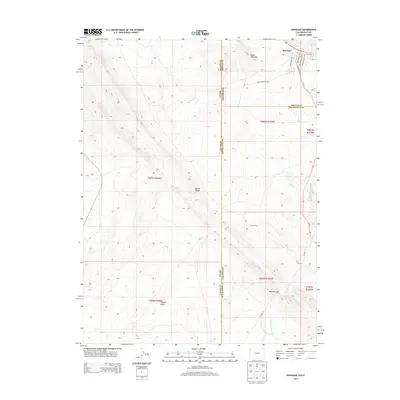
2013 Map of Dinosaur
USGS Topo · Published 2013About this map
The town of Dinosaur anchors the northern edge of this high-desert landscape where the borders of Utah and Colorado meet. This 2013 survey illustrates a unique intersection of geology and paleontology-inspired development, evidenced by residential streets like Triceratops Ter, Stegosaurus Fwy, and Brachiosaurus Byp. These thematic names reflect the proximity to fossil-rich deposits found throughout the surrounding badlands.
Find a feature on this map
26 named features on this map. Tap any name to fly to it.
Don’t see what you’re looking for? This feature index may not catch every label — zoom into the map to look around manually.
Map Details
Editions of this 2013 Dinosaur Map
This is the sole edition of this map. No revisions or reprints were ever made.
Other maps of this area

1885 · Ashley
USGS Topo · 1:250,000

1907 · Rangely
USGS Topo · 1:125,000

1907 · Jensen
USGS Topo · 1:125,000

1910 · Jensen
USGS Topo · 1:125,000

1910 · Rangely
USGS Topo · 1:125,000

1954 · Vernal
USGS Topo · 1:250,000

1958 · Vernal
USGS Topo · 1:250,000

1960 · Vernal
USGS Topo · 1:250,000
1962 · Mellen Hill
USGS Topo · 1:24,000
1962 · Plug Hat Rock
USGS Topo · 1:24,000