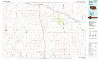
1985 Map of Dismal River
USGS Topo · Published 1985About this map
The Middle Loup River and Dismal River carve through the expansive sandhills of central Nebraska, defining a landscape shaped by hydrology and the steel of the Burlington Northern railroad. In the mid-1980s, this region remained a sparsely populated stretch of the Great Plains, where small rail-line settlements like Thedford, Halsey, and Dunning served as vital hubs for the surrounding ranching country. The presence of the Nebraska National Forest north of the Dismal River represents a massive human-made effort to plant timber in an naturally treeless environment, a project visible alongside various local water features such as Shimmins Lake and Mudd Lake. Landforms such as Shanklin Bluff and named valleys like Lone Valley and Sand Valley illustrate the subtle but significant topography of the plains, while remote locations like Tryon and Ringgold anchor the southern reaches of this transition zone.
Find a feature on this map
36 named features on this map. Tap any name to fly to it.
Don’t see what you’re looking for? This feature index may not catch every label — zoom into the map to look around manually.
Map Details
Editions of this 1985 Dismal River Map
2 editions found
Other maps of this area

1898 · Paxton
USGS Topo · 1:125,000

1899 · North Platte
USGS Topo · 1:125,000

1901 · Paxton
USGS Topo · 1:125,000

1902 · North Platte
USGS Topo · 1:125,000

1947 · Dismal River Ranch
USGS Topo · 1:62,500

1948 · Seneca
USGS Topo · 1:62,500

1948 · Thedford
USGS Topo · 1:62,500

1948 · Mullen
USGS Topo · 1:62,500

1948 · Linscott
USGS Topo · 1:62,500

1948 · Halsey
USGS Topo · 1:62,500