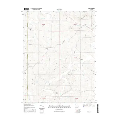
2015 Map of Dissen
USGS Topo · Published 2015About this map
Boeuf Creek and its many tributaries, including Cedar Fork and Prairie Fork, carve through this section of the Missouri landscape along the border of Gasconade and Franklin counties. The area is defined by a network of small, established communities such as Kohl City, Dissen, and Detmold. These settlements are linked by a dense grid of country roads, many of which carry the names of early local families and institutions, such as Schoeneberg Rd, Vedder Rd, and Grant School Rd.
Find a feature on this map
59 named features on this map. Tap any name to fly to it.
Don’t see what you’re looking for? This feature index may not catch every label — zoom into the map to look around manually.
Map Details
Editions of this 2015 Dissen Map
This is the sole edition of this map. No revisions or reprints were ever made.
Other maps of this area

1890 · Hermann
USGS Topo · 1:125,000

1903 · Sullivan
USGS Topo · 1:125,000

1935 · Gerald
USGS Topo · 1:48,000

1936 · Hermann
USGS Topo · 1:48,000

1941 · Gerald
USGS Topo · 1:62,500

1942 · Hermann
USGS Topo · 1:62,500

1944 · Gerald
USGS Topo · 1:62,500

1945 · Hermann
USGS Topo · 1:62,500

1946 · Union
USGS Topo · 1:62,500

1948 · Union
USGS Topo · 1:62,500