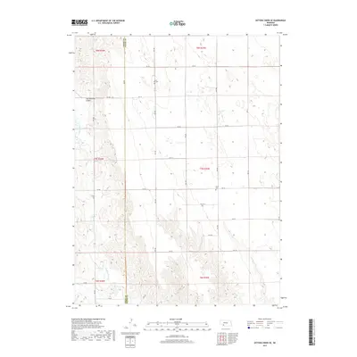
2017 Map of Dittons Creek SE
USGS Topo · Published 2017About this map
Stinking Water Creek and Spring Creek flow through this section of the High Plains, carving a landscape marked by the distinctive Cliff Dwellers Canyon. The area is defined by the survey grid system, where the border between Chase County and Hayes County serves as a primary axis for local movement. The map captures a sparsely populated ranching or farming region where the human imprint is focused on cemeteries and a strict network of section roads. For genealogists and local historians, the locations of Saint John Cemetery and Elmer Cemetery provide critical anchor points for family research in this rural expanse. The transport network, consisting of numerical routes like Road 744 and Avenue 348, illustrates the organized land division characteristic of Western Nebraska.
Find a feature on this map
29 named features on this map. Tap any name to fly to it.
Don’t see what you’re looking for? This feature index may not catch every label — zoom into the map to look around manually.
Map Details
Editions of this 2017 Dittons Creek SE Map
This is the sole edition of this map. No revisions or reprints were ever made.
Other maps of this area

1954 · McCook
USGS Topo · 1:250,000

1957 · McCook
USGS Topo · 1:250,000

1958 · McCook
USGS Topo · 1:250,000

1973 · Dittons Creek NE
USGS Topo · 1:24,000

1973 · Dittons Creek NW
USGS Topo · 1:24,000

1973 · Hayes Center NW
USGS Topo · 1:24,000

1974 · Hamlet
USGS Topo · 1:24,000

1974 · Dittons Creek SE
USGS Topo · 1:24,000
1974 · Wauneta West
USGS Topo · 1:24,000
1974 · Dittons Creek
USGS Topo · 1:24,000