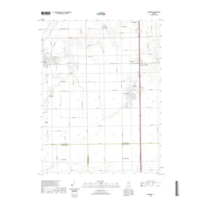
2018 Map of Divernon
USGS Topo · Published 2018About this map
Auburn and Divernon serve as the primary hubs in this portion of central Illinois, where the landscape transitions across the borders of Sangamon, Macoupin, and Montgomery counties. The area is defined by a network of rural routes and waterway-adjacent landmarks, notably the various burial grounds that anchor the local history, including Sugar Creek Cem, Cumberland Sugar Creek Cem, and Wimmer Cem. The northern reach of the quadrangle is marked by Glenarm, while the eastern side features the small community of Cimic near Pawnee Junction. Drainage patterns are dictated by the meandering paths of Sugar Cr and Brush Cr, which carve through the agricultural grid. To the west, the community of Thayer sits at the edge of this detailed survey, illustrating the proximity of these small towns to one another. The presence of Lake Commanche provides a distinct geographic break from the surrounding fields and stream valleys.
Find a feature on this map
109 named features on this map. Tap any name to fly to it.
Don’t see what you’re looking for? This feature index may not catch every label — zoom into the map to look around manually.
Map Details
Editions of this 2018 Divernon Map
This is the sole edition of this map. No revisions or reprints were ever made.
Other maps of this area

1922 · Divernon
USGS Topo · 1:62,500

1923 · Carlinville
USGS Topo · 1:48,000

1923 · Raymond
USGS Topo · 1:62,500

1924 · Divernon
USGS Topo · 1:62,500

1924 · Waverly
USGS Topo · 1:62,500

1925 · Carlinville
USGS Topo · 1:62,500

1925 · Raymond
USGS Topo · 1:62,500

1926 · Waverly
USGS Topo · 1:62,500

1931 · Carlinville
USGS Topo · 1:62,500

1958 · Decatur
USGS Topo · 1:250,000