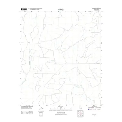
2012 Map of Divide
USGS Topo · Published 2012About this map
The settlement of Divide sits at the heart of this Coke County landscape, serving as a central point for a network of rural roads including Cemetery Rd and FM-2034. The terrain is defined by an intricate drainage system, with the headwaters of several seasonal streams branching across the plains. Notable waterways include Salt Cr in the north and the sprawling reach of Paint Cr, while the southern portion of the quadrangle is marked by the winding paths of W Fork Grape Cr and E Fork Grape Cr.
Find a feature on this map
16 named features on this map. Tap any name to fly to it.
Don’t see what you’re looking for? This feature index may not catch every label — zoom into the map to look around manually.
Map Details
Editions of this 2012 Divide Map
This is the sole edition of this map. No revisions or reprints were ever made.
Other maps of this area

1954 · San Angelo
USGS Topo · 1:250,000

1957 · Carlsbad
USGS Topo · 1:62,500

1958 · San Angelo
USGS Topo · 1:250,000

1962 · Edith
USGS Topo · 1:24,000
1962 · Millican Mountains
USGS Topo · 1:24,000

1962 · Green Mountain
USGS Topo · 1:24,000

1965 · San Angelo
USGS Topo · 1:250,000

1972 · Dog Creek NE
USGS Topo · 1:24,000

1972 · Broome
USGS Topo · 1:24,000
1972 · Crawford Slide
USGS Topo · 1:24,000