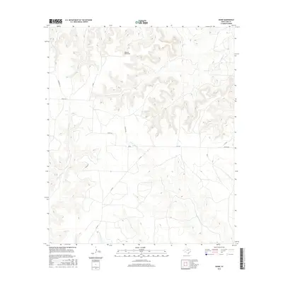
2016 Map of Divide
USGS Topo · Published 2016About this map
Divide sits as the central point of interest in this portion of Coke County, where the high plateau landscape transitions into a network of drainage systems. The local road network, including Cemetery Rd and Walnut Rd, reflects a history of rural land divisions and small-scale ranching. This geography is defined by its watercourses, most notably the numerous forks of the Grape Creek system. W Fork Grape Cr and E Fork Grape Cr carve through the terrain alongside other significant drainages like Paint Cr and Salt Cr. The presence of Natural Well Draw suggests a reliance on specific topographic features for water access in an otherwise arid environment, while routes like S FM 2034 provide the primary modern connection through the region.
Find a feature on this map
14 named features on this map. Tap any name to fly to it.
Don’t see what you’re looking for? This feature index may not catch every label — zoom into the map to look around manually.
Map Details
Editions of this 2016 Divide Map
This is the sole edition of this map. No revisions or reprints were ever made.
Other maps of this area

1954 · San Angelo
USGS Topo · 1:250,000

1957 · Carlsbad
USGS Topo · 1:62,500

1958 · San Angelo
USGS Topo · 1:250,000

1962 · Edith
USGS Topo · 1:24,000
1962 · Millican Mountains
USGS Topo · 1:24,000

1962 · Green Mountain
USGS Topo · 1:24,000

1965 · San Angelo
USGS Topo · 1:250,000

1972 · Dog Creek NE
USGS Topo · 1:24,000

1972 · Broome
USGS Topo · 1:24,000
1972 · Crawford Slide
USGS Topo · 1:24,000