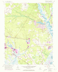
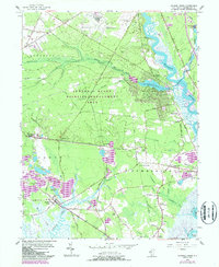
1956 Map of Dividing Creek
USGS Topo · Published 1973About this map
Maurice River frontage and the wetlands of the Buckshutem Swamp define the landscape of southern Cumberland County as it appeared in the mid-20th century. The settlement of Dividing Creek is shown in detail, situated among the namesake waterways of Dividing Creek and Cedar Creek. This area illustrates the transition from the upland woods of the State Hunting and Fishing Grounds to the marshy tracts of Cub Swamp and Cranberry Gut. Significant infrastructure of the era is evident, including the Central Railroad of New Jersey and the Pennsylvania-Reading Seashore Lines, which facilitated movement between regional hubs like Mauricetown and Port Norris. Local industry and utility are marked by numerous Sand Pits and the sprawling Millville Municipal Airport, while smaller communities such as Haleyville and Dragston remain anchored to the established road network.
Find a feature on this map
75 named features on this map. Tap any name to fly to it.
Don’t see what you’re looking for? This feature index may not catch every label — zoom into the map to look around manually.
Map Details
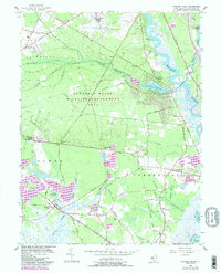
Editions of this 1956 Dividing Creek Map
6 editions found
Other maps of this area

1888 · Dennisville
USGS Topo · 1:62,500

1890 · Tuckahoe
USGS Topo · 1:62,500

1890 · Maurice Cove
USGS Topo · 1:62,500

1890 · Bridgeton
USGS Topo · 1:62,500

1891 · Maurice Cove
USGS Topo · 1:62,500

1893 · Tuckahoe
USGS Topo · 1:62,500

1894 · Dennisville
USGS Topo · 1:62,500

1894 · Bridgeton
USGS Topo · 1:62,500

1899 · Vineland
USGS Topo · 1:125,000

1918 · Tuckahoe
USGS Topo · 1:62,500
Featured Places
- Millville, NJ
- Maurice River Township, NJ
- Commercial Township, NJ
- Lawrence Township, NJ
- Downe Township, NJ