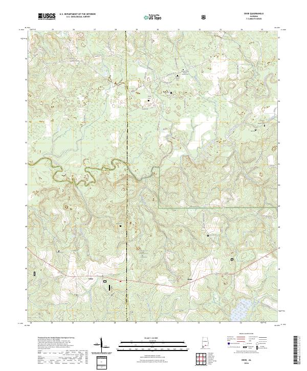
2024 Map of Dixie
USGS Topo · Published 2024About this map
The Conecuh National Forest dominates much of this landscape, where the intersections of Covington, Conecuh, and Escambia counties converge. Small settlements like Dixie and Rome represent the local hubs of activity, while the terrain is defined by a dense network of watercourses including the Conecuh River, Panther Creek, and Blue Creek. The abundance of small family and community burial sites, such as Peacock Cem, Dixon Cem, and Mason Cem, suggests a long history of rural residence and kinship ties within these wooded areas. Spiritual life is centered around institutions like Mobley Creek Baptist Church and Welfare Church. The infrastructure is characterized by winding rural routes such as Harts Bridge Rd and Brooklyn Rd, which navigate the many drainages and creek bottoms that feed into Rome Pond.
Find a feature on this map
49 named features on this map. Tap any name to fly to it.
Don’t see what you’re looking for? This feature index may not catch every label — zoom into the map to look around manually.
Map Details
Editions of this 2024 Dixie Map
This is the sole edition of this map. No revisions or reprints were ever made.
Other maps of this area

1953 · Andalusia
USGS Topo · 1:250,000

1957 · Andalusia
USGS Topo · 1:250,000

1971 · Dixie
USGS Topo · 1:24,000

1971 · Bradley
USGS Topo · 1:24,000

1971 · Carolina
USGS Topo · 1:24,000

1971 · Wing
USGS Topo · 1:24,000

1971 · River Falls
USGS Topo · 1:24,000

1971 · Loango
USGS Topo · 1:24,000

1982 · Damascus
USGS Topo · 1:24,000
1982 · Brooklyn
USGS Topo · 1:24,000