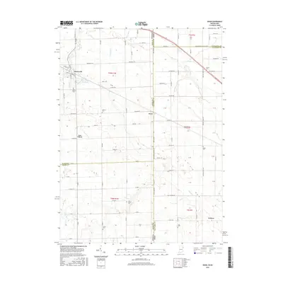
2016 Map of Dixon
USGS Topo · Published 2016About this map
Monroeville sits at the intersection of local history and state lines in this survey of the Indiana-Ohio border. The landscape is defined by its agricultural grid and a network of waterways including Flatrock Cr, Blue Cr, and Scott Ditch. Genealogists will find a high concentration of burial grounds throughout the area, from the Odd Fellows Cem near the town center to family and community sites like Hoffman Cem, Metzer Cem, and Bethel Cem. Small crossroad settlements such as East Liberty and Wolfcale dot the rural expanse, connected by a dense web of named roads including Monroeville Rd and Flatrock Rd. The border itself is marked by the IN OH State Line and State Line Rd, dividing Allen and Adams counties in Indiana from Van Wert County in Ohio.
Find a feature on this map
77 named features on this map. Tap any name to fly to it.
Don’t see what you’re looking for? This feature index may not catch every label — zoom into the map to look around manually.
Map Details
Editions of this 2016 Dixon Map
This is the sole edition of this map. No revisions or reprints were ever made.
Other maps of this area

1914 · Van Wert
USGS Topo · 1:62,500

1914 · Paulding
USGS Topo · 1:62,500

1944 · Van Wert
USGS Topo · 1:62,500

1944 · Paulding
USGS Topo · 1:62,500

1953 · Fort Wayne
USGS Topo · 1:250,000

1953 · Muncie
USGS Topo · 1:250,000

1956 · Muncie
USGS Topo · 1:250,000

1956 · Fort Wayne
USGS Topo · 1:250,000

1957 · Maples
USGS Topo · 1:24,000

1958 · Woodburn South
USGS Topo · 1:24,000