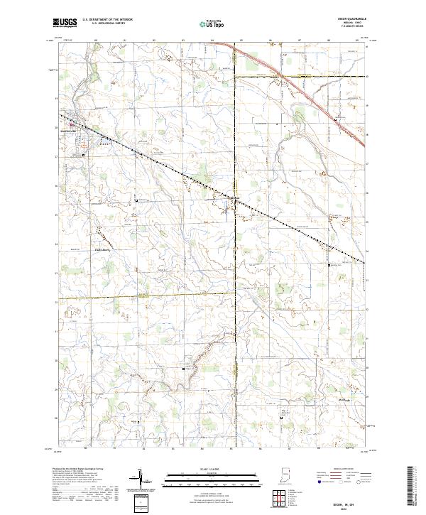
2022 Map of Dixon
USGS Topo · Published 2022About this map
Monroeville anchors the western edge of this landscape, where the town layout meets the agricultural grid of the Indiana and Ohio borderlands. The boundary between these two states is clearly delineated by State Line Rd and Ohio Indiana State Line Rd, cutting through the small settlement of Dixon. This rural region is defined by an extensive network of drainage systems such as Flatrock Cr, Blue Cr, and Scott Ditch, which support the surrounding farmland.
Find a feature on this map
85 named features on this map. Tap any name to fly to it.
Don’t see what you’re looking for? This feature index may not catch every label — zoom into the map to look around manually.
Map Details
Editions of this 2022 Dixon Map
This is the sole edition of this map. No revisions or reprints were ever made.
Other maps of this area

1914 · Van Wert
USGS Topo · 1:62,500

1914 · Paulding
USGS Topo · 1:62,500

1944 · Van Wert
USGS Topo · 1:62,500

1944 · Paulding
USGS Topo · 1:62,500

1953 · Fort Wayne
USGS Topo · 1:250,000

1953 · Muncie
USGS Topo · 1:250,000

1956 · Muncie
USGS Topo · 1:250,000

1956 · Fort Wayne
USGS Topo · 1:250,000

1957 · Maples
USGS Topo · 1:24,000

1958 · Woodburn South
USGS Topo · 1:24,000