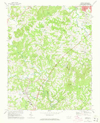
1971 Map of Dobson
USGS Topo · Published 1973About this map
Dobson serves as the central hub of this 1970s survey, showing a landscape defined by the winding course of the Fisher River and its numerous tributaries. The town’s civic infrastructure is well-documented, featuring the Surry County Community College campus, a Drive-In Theater, and multiple utility sites like the Filtration Plant and Water Tank. To the northeast, the settlement of Toast and the Franklin Sch indicate pockets of residential growth along the road network leading toward larger regional centers.
Find a feature on this map
42 named features on this map. Tap any name to fly to it.
Don’t see what you’re looking for? This feature index may not catch every label — zoom into the map to look around manually.
Map Details
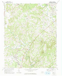
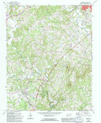
Editions of this 1971 Dobson Map
Other maps of this area

1889 · Hillsville
USGS Topo · 1:125,000

1891 · Yadkinville
USGS Topo · 1:125,000

1892 · Hillsville
USGS Topo · 1:125,000

1893 · Yadkinville
USGS Topo · 1:125,000

1896 · Hillsville
USGS Topo · 1:125,000

1931 · Galax
USGS Topo · 1:48,000

1933 · Galax
USGS Topo · 1:62,500

1953 · Winston-Salem
USGS Topo · 1:250,000

1955 · Winston-Salem
USGS Topo · 1:250,000

1957 · Mount Airy
USGS Topo · 1:62,500