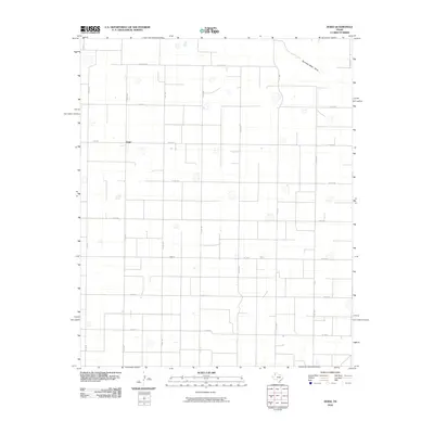
2010 Map of Dodd
USGS Topo · Published 2010About this map
The settlement of Dodd serves as the focal point for this section of the High Plains, where the landscape is organized by an extensive grid of section-line roads and seasonal watercourses. The drainage of Running Water Draw cuts across the northeastern corner, indicating the natural hydrology of Castro County in an otherwise heavily modified agricultural environment. Transportation across these plains relies on a network of Farm to Market roads, specifically FM 3458 and FM 1055, which connect the small community to the surrounding farmsteads. The map reveals the precise layout of local infrastructure, from Co RD 627a in the north to Co RD 64 in the south, reflecting the geometric precision of the Texas Panhandle's land use and property boundaries.
Find a feature on this map
24 named features on this map. Tap any name to fly to it.
Don’t see what you’re looking for? This feature index may not catch every label — zoom into the map to look around manually.
Map Details
Editions of this 2010 Dodd Map
This is the sole edition of this map. No revisions or reprints were ever made.
Other maps of this area

1954 · Clovis
USGS Topo · 1:250,000

1958 · Clovis
USGS Topo · 1:250,000

1962 · Muleshoe NE
USGS Topo · 1:24,000

1962 · Dodd NE
USGS Topo · 1:24,000

1962 · Springlake
USGS Topo · 1:24,000

1963 · Flagg
USGS Topo · 1:24,000

1963 · Earth
USGS Topo · 1:24,000

1963 · Lazbuddie
USGS Topo · 1:24,000

1963 · Dodd SE
USGS Topo · 1:24,000

1963 · Dodd
USGS Topo · 1:24,000