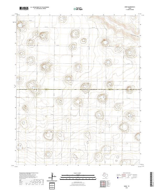
2022 Map of Dodd
USGS Topo · Published 2022About this map
Running Water Draw carves a subtle path through the northeastern corner of this agricultural landscape on the High Plains, where the border between Castro Co and Lamb Co bisects a grid of rural transport routes. The terrain is characterized by a high density of depression contours, indicating the numerous playa lakes typical of this region. These natural features are surrounded by a precise network of county roads, including Co Rd 630 and Co Rd 119, which facilitate the movement of goods across these vast farm and ranch lands. Farm-to-Market roads like FM 1055, FM 3458, and FM 2901 serve as the primary arteries connecting the scattered homesteads and agricultural operations of the Llano Estacado. The absence of concentrated town sites emphasizes the decentralized, land-intensive character of the local economy during this period.
Find a feature on this map
26 named features on this map. Tap any name to fly to it.
Don’t see what you’re looking for? This feature index may not catch every label — zoom into the map to look around manually.
Map Details
Editions of this 2022 Dodd Map
This is the sole edition of this map. No revisions or reprints were ever made.
Other maps of this area

1954 · Clovis
USGS Topo · 1:250,000

1958 · Clovis
USGS Topo · 1:250,000

1962 · Muleshoe NE
USGS Topo · 1:24,000

1962 · Dodd NE
USGS Topo · 1:24,000

1962 · Springlake
USGS Topo · 1:24,000

1963 · Flagg
USGS Topo · 1:24,000

1963 · Earth
USGS Topo · 1:24,000

1963 · Lazbuddie
USGS Topo · 1:24,000

1963 · Dodd SE
USGS Topo · 1:24,000

1963 · Dodd
USGS Topo · 1:24,000