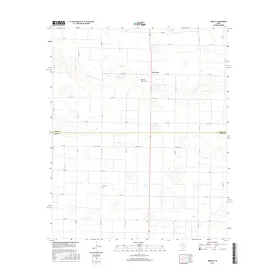
2016 Map of Dodd SE
USGS Topo · Published 2016About this map
Sunnyside serves as the primary landmark in this agricultural landscape on the High Plains of the Texas Panhandle. The terrain is defined by a series of shallow depressions and the ephemeral course of Running Water Draw, which meanders through the northern section of the map. This 2016 survey captures the precise layout of the rural road grid, where county lines separate Castro and Lamb counties. Local history and genealogy researchers will find the Springlake Cem located in the southwestern portion of the sheet, providing a specific point of reference for family histories in this part of Lamb County. The map details a network of farm-to-market roads and local routes, including El Paso Camp Rd and Fm 2901, which facilitate the region's agricultural economy and connect scattered farmsteads across the level plains.
Find a feature on this map
26 named features on this map. Tap any name to fly to it.
Don’t see what you’re looking for? This feature index may not catch every label — zoom into the map to look around manually.
Map Details
Editions of this 2016 Dodd SE Map
This is the sole edition of this map. No revisions or reprints were ever made.
Other maps of this area

1954 · Clovis
USGS Topo · 1:250,000

1958 · Clovis
USGS Topo · 1:250,000

1962 · Dodd NE
USGS Topo · 1:24,000

1962 · Springlake
USGS Topo · 1:24,000

1963 · Flagg
USGS Topo · 1:24,000

1963 · Hart NW
USGS Topo · 1:24,000

1963 · Earth
USGS Topo · 1:24,000

1963 · Olton
USGS Topo · 1:24,000

1963 · Dodd SE
USGS Topo · 1:24,000

1963 · Dodd
USGS Topo · 1:24,000