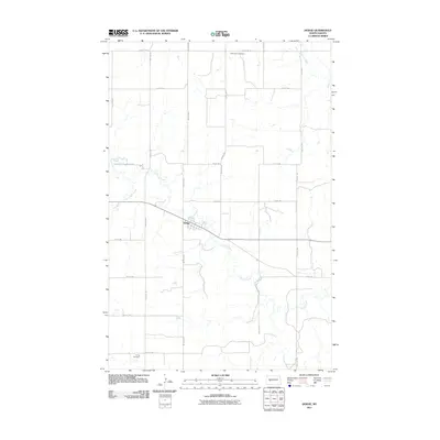
2011 Map of Dodge
USGS Topo · Published 2011About this map
Dodge occupies a central position in this North Dakota landscape, situated where several local drainage systems converge. The settlement is defined by a grid of streets and its orientation along the path of Spring Creek, which meanders southeastward across the prairie. To the north, Saint Pauls Cemetery serves as a significant local landmark, while Loring Cemetery is located in the southern reaches of the quadrangle. The surrounding rural character is shaped by the presence of Cottonwood Creek and Goodman Creek, with a systematic network of section-line roads like County Rd 26 and 80th Ave SW providing access to the agricultural hinterlands. This survey illustrates the classic Great Plains settlement pattern where small towns and rural cemeteries are anchored by natural waterways and a precise transportation grid.
Find a feature on this map
23 named features on this map. Tap any name to fly to it.
Don’t see what you’re looking for? This feature index may not catch every label — zoom into the map to look around manually.
Map Details
Editions of this 2011 Dodge Map
This is the sole edition of this map. No revisions or reprints were ever made.
Other maps of this area

1953 · Watford City
USGS Topo · 1:250,000

1957 · Watford City
USGS Topo · 1:250,000

1967 · Watford City
USGS Topo · 1:250,000

1970 · Halliday NE
USGS Topo · 1:24,000
1970 · Golden Valley NE
USGS Topo · 1:24,000

1970 · Golden Valley NW
USGS Topo · 1:24,000

1973 · Schaffner Creek NE
USGS Topo · 1:24,000

1973 · Schaffner Creek
USGS Topo · 1:24,000

1973 · Halliday
USGS Topo · 1:24,000

1973 · Dodge
USGS Topo · 1:24,000