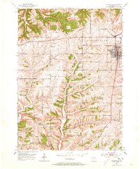
1952 Map of Dodgeville
USGS Topo · Published 1973About this map
The city of Dodgeville serves as a focal point at the junction of rail and road in the early 1950s, anchored by the Chicago and North Western railroad line. The landscape is defined by the steep, dendritic drainage patterns of the Mineral Point Branch and Pedler Creek, which carve through the townships of Linden and Mineral Point. A dense network of rural infrastructure supports the agricultural community, including an exceptional concentration of one-room schoolhouses such as Oaklawn Sch, Pine Grove Sch, and Barreltown Sch.
Find a feature on this map
24 named features on this map. Tap any name to fly to it.
Don’t see what you’re looking for? This feature index may not catch every label — zoom into the map to look around manually.
Map Details
Editions of this 1952 Dodgeville Map
3 editions found
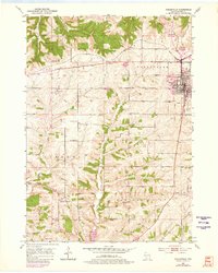
Other maps of this area

1902 · Mineral Point
USGS Topo · 1:125,000

1905 · Richland Center
USGS Topo · 1:125,000

1952 · Mineral Point
USGS Topo · 1:24,000

1952 · Dodgeville
USGS Topo · 1:24,000

1952 · Linden
USGS Topo · 1:24,000

1952 · Mifflin
USGS Topo · 1:24,000

1958 · La Crosse
USGS Topo · 1:250,000

1959 · Dubuque
USGS Topo · 1:250,000

1960 · Muscoda
USGS Topo · 1:62,500

1960 · Spring Green
USGS Topo · 1:62,500