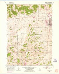
1952 Map of Dodgeville
USGS Topo · Published 1980About this map
Dodgeville serves as the focal point of this Midwestern landscape, showing a detailed network of civil and religious infrastructure in the mid-20th century. The town's grid is anchored by St Joseph Hospital and punctuated by local institutions like the County Home and Oaklawn Sch. Outside the central hub, the terrain is defined by the deep valleys of Mineral Point Branch and Martin Creek, where rural life is marked by several country schools including North Survey Sch and Bloomfield Sch.
Find a feature on this map
30 named features on this map. Tap any name to fly to it.
Don’t see what you’re looking for? This feature index may not catch every label — zoom into the map to look around manually.
Map Details
Editions of this 1952 Dodgeville Map
3 editions found
Other maps of this area

1902 · Mineral Point
USGS Topo · 1:125,000

1905 · Richland Center
USGS Topo · 1:125,000

1952 · Mineral Point
USGS Topo · 1:24,000

1952 · Dodgeville
USGS Topo · 1:24,000

1952 · Linden
USGS Topo · 1:24,000

1952 · Mifflin
USGS Topo · 1:24,000

1958 · La Crosse
USGS Topo · 1:250,000

1959 · Dubuque
USGS Topo · 1:250,000

1960 · Muscoda
USGS Topo · 1:62,500

1960 · Spring Green
USGS Topo · 1:62,500