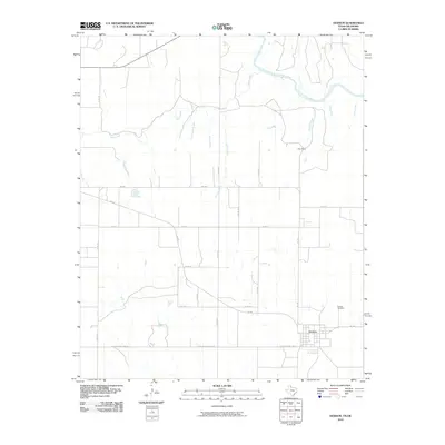
2010 Map of Dodson
USGS Topo · Published 2010About this map
Dodson serves as the primary hub of this eastern Collingsworth County landscape, situated near the Oklahoma border. The town's grid is clearly defined, with the Dodson Cemetery located just to the northeast along FM 338. This area of the Texas Panhandle is characterized by a series of north-flowing watercourses that feed into the Salt Fork Red River, which cuts across the northern section of the map. These drainages, including Sand Creek, Uncle Frank Creek, and Junkie Creek, create a corrugated terrain that dictates the placement of the rural road network.
Find a feature on this map
23 named features on this map. Tap any name to fly to it.
Don’t see what you’re looking for? This feature index may not catch every label — zoom into the map to look around manually.
Map Details
Editions of this 2010 Dodson Map
This is the sole edition of this map. No revisions or reprints were ever made.
Other maps of this area

1954 · Plainview
USGS Topo · 1:250,000

1955 · Lawton
USGS Topo · 1:250,000

1958 · Plainview
USGS Topo · 1:250,000

1959 · Wellington NW
USGS Topo · 1:24,000

1959 · Shinnery Creek
USGS Topo · 1:24,000

1960 · Loco
USGS Topo · 1:62,500

1961 · Hollis
USGS Topo · 1:62,500

1964 · Wellington
USGS Topo · 1:24,000

1964 · Dodson
USGS Topo · 1:24,000
1971 · Madge
USGS Topo · 1:24,000