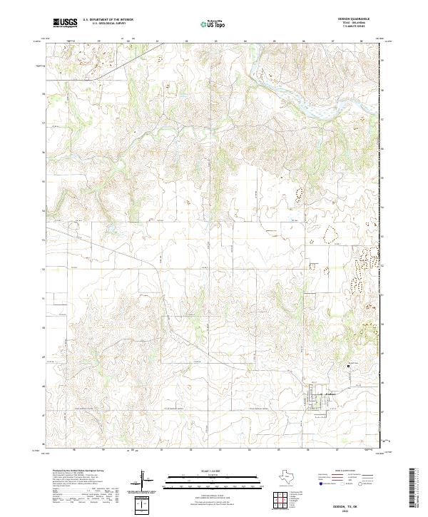
2022 Map of Dodson
USGS Topo · Published 2022About this map
The town of Dodson anchors this portion of the Texas-Oklahoma border, serving as a concentrated grid of settlement amidst a landscape defined by seasonal watercourses and agricultural roads. The northern reach is dominated by the Salt Fork Red River, which winds through the terrain near several curiously named tributaries such as Uncle Frank Cr, Junkie Cr, and Di Gob Cr. These drainages, along with Sand Creek Springs, emphasize the importance of water management in this semi-arid region. For those researching local history, the Dodson Cem sits north of the main town site, providing a primary genealogical anchor. The map reveals a highly structured rural transport network, with numbered county roads and farm-to-market routes like FM 1642 and FM 338 connecting the isolated ranching and farming tracts that characterize the Collingsworth County panhandle.
Find a feature on this map
37 named features on this map. Tap any name to fly to it.
Don’t see what you’re looking for? This feature index may not catch every label — zoom into the map to look around manually.
Map Details
Editions of this 2022 Dodson Map
This is the sole edition of this map. No revisions or reprints were ever made.
Other maps of this area

1954 · Plainview
USGS Topo · 1:250,000

1955 · Lawton
USGS Topo · 1:250,000

1958 · Plainview
USGS Topo · 1:250,000

1959 · Wellington NW
USGS Topo · 1:24,000

1959 · Shinnery Creek
USGS Topo · 1:24,000

1960 · Loco
USGS Topo · 1:62,500

1961 · Hollis
USGS Topo · 1:62,500

1964 · Wellington
USGS Topo · 1:24,000

1964 · Dodson
USGS Topo · 1:24,000
1971 · Madge
USGS Topo · 1:24,000