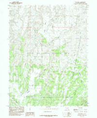
1985 Map of Dog Knoll
USGS Topo · Published 1985About this map
The Uintah and Ouray Indian Reservation and the Naval Oil Shale Reserve No 2 overlap in this mid-1980s Uintah County landscape. This territory is defined by a series of high tablelands and deep-cut drainage systems, including Benion Bench and the expansive Tabyago Basin. The transition from the high Flat in the southwest toward the drainage of Dog Knoll Draw illustrates the region's complex geology.
Find a feature on this map
19 named features on this map. Tap any name to fly to it.
Don’t see what you’re looking for? This feature index may not catch every label — zoom into the map to look around manually.
Map Details
Editions of this 1985 Dog Knoll Map
This is the sole edition of this map. No revisions or reprints were ever made.
Other maps of this area

1885 · East Tavaputs
USGS Topo · 1:250,000

1953 · Nutters Hole
USGS Topo · 1:62,500

1953 · Firewater Canyon
USGS Topo · 1:62,500

1956 · Grand Junction
USGS Topo · 1:250,000

1959 · Grand Junction
USGS Topo · 1:250,000

1960 · Grand Junction
USGS Topo · 1:250,000

1962 · Grand Junction
USGS Topo · 1:250,000

1964 · Grand Junction
USGS Topo · 1:250,000

1965 · Grand Junction
USGS Topo · 1:250,000
1966 · Flat Rock Mesa
USGS Topo · 1:24,000