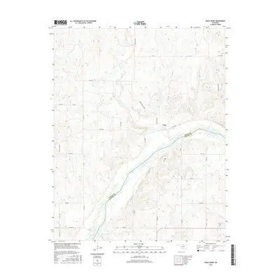
2016 Map of Doga Creek
USGS Topo · Published 2016About this map
The Arkansas River carves a deep southwest-to-northeast path across this portion of northern Oklahoma, forming a natural boundary between Osage Co and Pawnee Co. The settlement of Doga sits along the northern banks, where the terrain is defined by a dense network of watercourses including Doga Creek, Big Drum Cr, and Clear Cr. These streams dissect the uplands, creating a complex drainage system that feeds into the river valley.
Find a feature on this map
38 named features on this map. Tap any name to fly to it.
Don’t see what you’re looking for? This feature index may not catch every label — zoom into the map to look around manually.
Map Details
Editions of this 2016 Doga Creek Map
This is the sole edition of this map. No revisions or reprints were ever made.
Other maps of this area

1929 · Skedee
USGS Topo · 1:62,500

1930 · Pawnee
USGS Topo · 1:62,500

1931 · Skedee
USGS Topo · 1:62,500

1932 · Fairfax
USGS Topo · 1:62,500

1936 · Belford
USGS Topo · 1:62,500

1936 · Pawnee
USGS Topo · 1:62,500

1955 · Enid
USGS Topo · 1:250,000

1958 · Enid
USGS Topo · 1:250,000

1963 · Charley Creek
USGS Topo · 1:24,000

1964 · Charley Creek NE
USGS Topo · 1:24,000