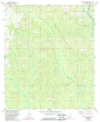
1978 Map of Dogwood Creek
USGS Topo · Published 1988About this map
The Perdido River forms the interstate boundary between Alabama and Florida in this 1970s landscape, weaving through a terrain defined by its complex drainage network. The small settlement of Pine Grove sits in the northwest, near an unnamed Cem, while High Pine Cem serves the rural population further east toward the river bends. This map documents a transitional industrial layer, showing numerous utility corridors and a Pumping Sta amidst the traditional timber and agricultural lands of Baldwin County.
Find a feature on this map
22 named features on this map. Tap any name to fly to it.
Don’t see what you’re looking for? This feature index may not catch every label — zoom into the map to look around manually.
Map Details
Editions of this 1978 Dogwood Creek Map
4 editions found
Other maps of this area

1920 · Robertsdale
USGS Topo · 1:62,500

1921 · Fairhope
USGS Topo · 1:62,500

1941 · Bay Minette
USGS Topo · 1:62,500

1941 · Robertsdale
USGS Topo · 1:62,500

1941 · Fairhope
USGS Topo · 1:62,500

1942 · Dyas
USGS Topo · 1:62,500

1943 · Robertsdale
USGS Topo · 1:62,500

1943 · Bay Minette
USGS Topo · 1:62,500
1943 · Fairhope
USGS Topo · 1:62,500
1944 · Stapleton
USGS Topo · 1:31,680