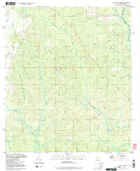
1994 Map of Dogwood Creek
USGS Topo · Published 1998About this map
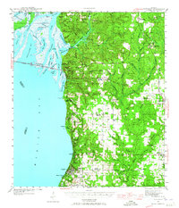
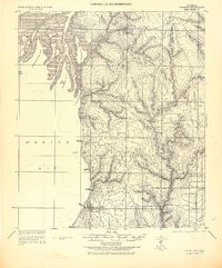
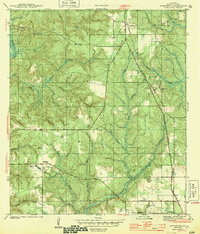
Pine Grove and its surrounding woodlands define this portion of Baldwin County in the mid-1990s, where the landscape is intricately divided by a network of seasonal and perennial watercourses. The map captures a transition point at the Florida Alabama state line, where the Perdido River and Dyas Creek flow through the eastern reaches. The interior is defined by a dendritic drainage pattern featuring Hollinger Creek, Dogwood Creek, and the Styx River, which dominate the low-lying terrain. Genealogy researchers can identify local landmarks such as High Pine Cem and a smaller Cemetery near the settlement of Pine Grove. Evidence of the local economy and infrastructure is visible through the presence of a Pumping Sta, several industrial sandpits, and the remnants of the timber or naval stores industry at Wiggins Still. Numerous pipelines crisscross the topography, indicating the region's role as a transit corridor for energy resources.
Find a feature on this map
21 named features on this map. Tap any name to fly to it.
Don’t see what you’re looking for? This feature index may not catch every label — zoom into the map to look around manually.
Map Details
Editions of this 1994 Dogwood Creek Map
2 editions found

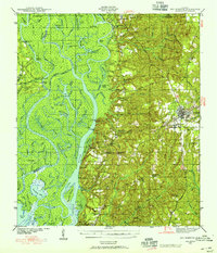
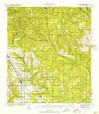
Other maps of this area
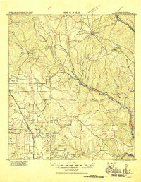
1920 · Robertsdale
USGS Topo · 1:62,500

1921 · Fairhope
USGS Topo · 1:62,500
1941 · Bay Minette
USGS Topo · 1:62,500
1941 · Robertsdale
USGS Topo · 1:62,500
1941 · Fairhope
USGS Topo · 1:62,500
1942 · Dyas
USGS Topo · 1:62,500
1943 · Robertsdale
USGS Topo · 1:62,500
1943 · Bay Minette
USGS Topo · 1:62,500
1943 · Fairhope
USGS Topo · 1:62,500
1944 · Stapleton
USGS Topo · 1:31,680