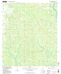
1994 Map of Dogwood Creek
USGS Topo · Published 1998About this map
The Perdido River and the state boundary between Alabama and Florida define the eastern reaches of this landscape, where the waters of the Gulf Coast hinterlands converge. Settlement is sparse, anchored primarily by Pine Grove and a network of rural routes like Brady Road and Dodd Road. The area is heavily intersected by infrastructure, featuring several prominent pipelines and a Pumping Sta, suggesting the industrial extraction and transport common to this coastal plain region during the late twentieth century.
Find a feature on this map
26 named features on this map. Tap any name to fly to it.
Don’t see what you’re looking for? This feature index may not catch every label — zoom into the map to look around manually.
Map Details
Editions of this 1994 Dogwood Creek Map
2 editions found
Other maps of this area

1920 · Robertsdale
USGS Topo · 1:62,500

1921 · Fairhope
USGS Topo · 1:62,500

1941 · Bay Minette
USGS Topo · 1:62,500

1941 · Robertsdale
USGS Topo · 1:62,500

1941 · Fairhope
USGS Topo · 1:62,500

1942 · Dyas
USGS Topo · 1:62,500

1943 · Robertsdale
USGS Topo · 1:62,500

1943 · Bay Minette
USGS Topo · 1:62,500
1943 · Fairhope
USGS Topo · 1:62,500
1944 · Stapleton
USGS Topo · 1:31,680