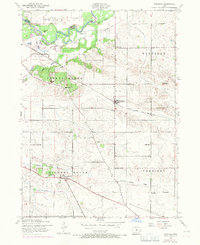
1953 Map of Donahue
USGS Topo · Published 1971About this map
The Wapsipinicon River meanders across the northern border of Scott County, defining the boundary with Clinton County and creating a landscape of wooded bends and wetlands like Allens Grove. This 1953 survey, updated with 1970 aerial data, reveals a deeply established rural infrastructure centered on the village of Donahue. The township is dotted with a dense network of local education centers, including the Linn Grove School, Harmann School, and West Maysville Independent School, reflecting the era's commitment to community-based schooling. Transportation is anchored by the Chicago Milwaukee St Paul and Pacific railroad, while a dismantled railroad near Buena Vista hints at shifting logistics. Significant landmarks like the Stanley Landing Field and the Allens Grove Cemetery provide specific touchpoints for local historians and genealogists tracking family ties in the Sheridan and Hickory Grove townships.
Find a feature on this map
31 named features on this map. Tap any name to fly to it.
Don’t see what you’re looking for? This feature index may not catch every label — zoom into the map to look around manually.
Map Details
Editions of this 1953 Donahue Map
Other maps of this area

1890 · Durant
USGS Topo · 1:62,500

1891 · DeWitt
USGS Topo · 1:62,500

1891 · Davenport
USGS Topo · 1:62,500

1892 · Wheatland
USGS Topo · 1:62,500

1894 · Wheatland
USGS Topo · 1:62,500

1894 · Durant
USGS Topo · 1:62,500

1894 · Davenport
USGS Topo · 1:62,500

1901 · Rock Island
USGS Topo · 1:125,000

1910 · Rock Island
USGS Topo · 1:125,000
1949 · Davenport
USGS Topo · 1:24,000