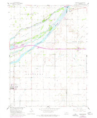
1962 Map of Doniphan
USGS Topo · Published 1977About this map
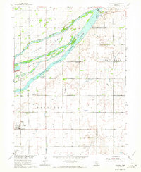
The braided waters of the Platte River dominate this Central Nebraska landscape, dividing the terrain into a complex system of channels and landforms like Mormon Island and Indian Island. Near the western edge, the town of Doniphan sits along the Union Pacific tracks, serving as a focal point for the surrounding agricultural townships of Washington, Deep Well, and Scovill. This survey captures the region as it appeared in the early 1960s with updates from the mid-1970s, illustrating a transition from traditional rural patterns to modern infrastructure. Educational and social life is anchored by rural institutions such as School No 19 and School No 40, while the presence of Camp Cosmopolitan and Camp Augustine along the riverbanks suggests the area's role as a recreational retreat. To the northeast, the Radio Towers (KRGI) stand near Riverside Lake, marking the encroaching influence of the regional hub of Grand Island.
Find a feature on this map
26 named features on this map. Tap any name to fly to it.
Don’t see what you’re looking for? This feature index may not catch every label — zoom into the map to look around manually.
Map Details
Editions of this 1962 Doniphan Map
3 editions found
Other maps of this area

1892 · Grand Island
USGS Topo · 1:62,500

1895 · Grand Island
USGS Topo · 1:62,500

1898 · Grand Island
USGS Topo · 1:125,000

1955 · Grand Island
USGS Topo · 1:250,000

1957 · Grand Island
USGS Topo · 1:250,000

1958 · Grand Island
USGS Topo · 1:250,000
1962 · Abbott
USGS Topo · 1:24,000
1962 · Phillips
USGS Topo · 1:24,000
1962 · Doniphan
USGS Topo · 1:24,000
1962 · Grand Island
USGS Topo · 1:24,000