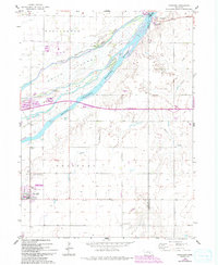
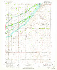
1962 Map of Doniphan
USGS Topo · Published 1993About this map
Doniphan sits at the southwestern edge of this landscape, where the Union Pacific rail line cuts across the plains toward the sprawling braided channels of the Platte River. The river dominates the northern half of the map, carving the land into large landmasses like Indian Island and Mormon Island. The latter is partially preserved as the Mormon Island State Wildlife Management Area, reflecting a transition from early settlement use to modern conservation.
Find a feature on this map
22 named features on this map. Tap any name to fly to it.
Don’t see what you’re looking for? This feature index may not catch every label — zoom into the map to look around manually.
Map Details
Editions of this 1962 Doniphan Map
3 editions found
Other maps of this area

1892 · Grand Island
USGS Topo · 1:62,500

1895 · Grand Island
USGS Topo · 1:62,500

1898 · Grand Island
USGS Topo · 1:125,000

1955 · Grand Island
USGS Topo · 1:250,000

1957 · Grand Island
USGS Topo · 1:250,000

1958 · Grand Island
USGS Topo · 1:250,000
1962 · Abbott
USGS Topo · 1:24,000
1962 · Phillips
USGS Topo · 1:24,000
1962 · Doniphan
USGS Topo · 1:24,000
1962 · Grand Island
USGS Topo · 1:24,000