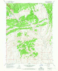
1965 Map of Donkey Flat
USGS Topo · Published 1967About this map
Ashley National Forest dominates the northern landscape of this mid-1960s survey, where the high terrain breaks into a complex network of drainages including Hole-in-the-wall Canyon, Pothole Canyon, and Constantine Canyon. The geography is defined by a transition from these wooded uplands down into the broad open expanses of Donkey Flat and Little Donkey Flat. Resource extraction and industrial water management are evident in the northwest corner, marked by a Strip Mine, associated Storage Bins, and an Industrial Waste Pond. Hydrological monitoring is centered on Big Brush Creek, where a Gaging Station tracks the flow through the arid basin. To the south, the topographic relief rises again into the Buck Skin Hills, a region crisscrossed by a Jeep Trail and a significant Pipeline, reflecting the mid-century infrastructure required to navigate and utilize this remote section of Uintah County.
Find a feature on this map
24 named features on this map. Tap any name to fly to it.
Don’t see what you’re looking for? This feature index may not catch every label — zoom into the map to look around manually.
Map Details
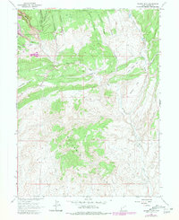
Editions of this 1965 Donkey Flat Map
2 editions found
Other maps of this area

1885 · Ashley
USGS Topo · 1:250,000

1906 · Marsh Peak
USGS Topo · 1:125,000

1907 · Jensen
USGS Topo · 1:125,000

1908 · Marsh Peak
USGS Topo · 1:125,000

1910 · Jensen
USGS Topo · 1:125,000

1917 · Vernal
USGS Topo · 1:125,000

1950 · Burnt Cabin Gorge
USGS Topo · 1:24,000

1950 · Blair Basin
USGS Topo · 1:24,000

1950 · Dyer Mountain
USGS Topo · 1:24,000

1954 · Vernal
USGS Topo · 1:250,000