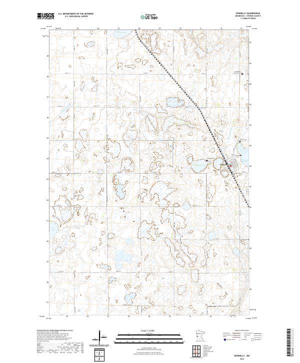
2022 Map of Donnelly
USGS Topo · Published 2022About this map
The town of Donnelly anchors this western Minnesota landscape, characterized by a dense network of prairie potholes and small lakes. Settlement patterns here follow a strict sectional grid, yet the local genealogy is preserved in numerous burial grounds, including Kongsvinger Lutheran Cem and Vinger Cem. The hydrology is defined by slow-moving drainage such as Twelvemile Cr and varied wetlands like Harstad Slough and Lundberg Lake. The town itself is uniquely platted with street names echoing European cities, including Edinburgh Ave, Balmoral Ave, and Glasgow Ave. This concentration of cemeteries and the specifically named street grid provide valuable data for researchers tracing the development of Stevens County and the cultural heritage of its early residents.
Find a feature on this map
36 named features on this map. Tap any name to fly to it.
Don’t see what you’re looking for? This feature index may not catch every label — zoom into the map to look around manually.
Map Details
Editions of this 2022 Donnelly Map
This is the sole edition of this map. No revisions or reprints were ever made.
Other maps of this area

1910 · Chokio
USGS Topo · 1:62,500

1911 · Barrett
USGS Topo · 1:62,500

1911 · Herman
USGS Topo · 1:62,500

1912 · Chokio
USGS Topo · 1:62,500

1912 · Morris
USGS Topo · 1:62,500

1953 · Milbank
USGS Topo · 1:250,000

1953 · Saint Cloud
USGS Topo · 1:250,000

1957 · Saint Cloud
USGS Topo · 1:250,000

1958 · Milbank
USGS Topo · 1:250,000

1958 · Saint Cloud
USGS Topo · 1:250,000