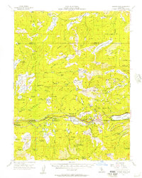
1955 Map of Donner Pass
USGS Topo · Published 1957About this map
Donner Pass serves as the central anchor of this mid-century survey, illustrating the critical transportation corridor where the Southern Pacific Railroad and the Donner Trail cross the Sierra Nevada crest. The map captures a transition in high-altitude land use, from the historic wagon route of the Henness Pass Road in the north to the burgeoning recreational and seasonal settlements like Soda Springs, Norden, and Kingvale along the rail line. Numerous alpine water bodies, including Webber Lake, Independence Lake, and Lake Van Norden, dominate the landscape, while the southeastern corner identifies the Donner Memorial State Park near the shore of Donner Lake. The inclusion of the Old Stanford Wood Camp (Site) and various organized camps like Camp Pahatsi and Buttee Area Camp points to the area's long history as both a logging resource and a destination for summer retreats within the Tahoe National Forest.
Find a feature on this map
98 named features on this map. Tap any name to fly to it.
Don’t see what you’re looking for? This feature index may not catch every label — zoom into the map to look around manually.
Map Details
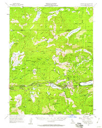
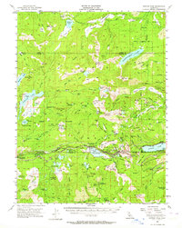
Editions of this 1955 Donner Pass Map
4 editions found

Other maps of this area

1890 · Sierraville
USGS Topo · 1:125,000

1891 · Downieville
USGS Topo · 1:125,000

1891 · Colfax
USGS Topo · 1:125,000

1891 · Truckee
USGS Topo · 1:125,000

1892 · Sierraville
USGS Topo · 1:125,000

1892 · Colfax
USGS Topo · 1:125,000

1893 · Truckee
USGS Topo · 1:125,000

1893 · Downieville
USGS Topo · 1:125,000

1894 · Colfax
USGS Topo · 1:125,000

1894 · Sierraville
USGS Topo · 1:125,000