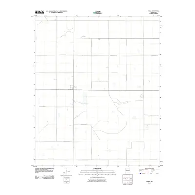
2010 Map of Dora
USGS Topo · Published 2010About this map
Dora serves as the central hub of this eastern New Mexico landscape, situated at the intersection of a vast grid of county roads. The settlement is anchored by the Dora Post Office, marking its role as a vital rural community point. To the north, Mount Zion Cemetery provides a significant touchstone for genealogical research and local heritage. The terrain is defined by a strictly organized transportation network, including thoroughfares such as S Roosevelt Road 18 and S Roosevelt Road 26, which divide the high plains into precise sections. This 2010 survey illustrates the enduring agricultural structure of Roosevelt County, where the placement of cemeteries and post offices reveals the focal points of a sparsely populated but deeply rooted region.
Find a feature on this map
17 named features on this map. Tap any name to fly to it.
Don’t see what you’re looking for? This feature index may not catch every label — zoom into the map to look around manually.
Map Details
Editions of this 2010 Dora Map
This is the sole edition of this map. No revisions or reprints were ever made.
Other maps of this area

1954 · Clovis
USGS Topo · 1:250,000

1954 · Brownfield
USGS Topo · 1:250,000

1957 · Arch
USGS Topo · 1:62,500

1957 · Portales
USGS Topo · 1:62,500

1958 · Brownfield
USGS Topo · 1:250,000

1958 · Clovis
USGS Topo · 1:250,000

1962 · Brownfield
USGS Topo · 1:250,000

1972 · Dora NW
USGS Topo · 1:24,000

1972 · Garrison
USGS Topo · 1:24,000

1972 · Dora SW
USGS Topo · 1:24,000