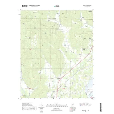
2018 Map of Doran Cove
USGS Topo · Published 2018About this map
Russell Cave National Monument anchors this northern Alabama landscape, marking a prehistoric site of long-term human habitation in the karst topography of the Cumberland Plateau. The map reveals a complex network of springs and streams, such as Cloud Spring, Graham Springs, and Blue Spring, which feed into Widows Creek and eventually the waters of Guntersville Lake. This hydrological pattern, combined with the presence of Coopers Mill, suggests a long history of water-dependent settlement and early industry in the cove.
Find a feature on this map
132 named features on this map. Tap any name to fly to it.
Don’t see what you’re looking for? This feature index may not catch every label — zoom into the map to look around manually.
Map Details
Editions of this 2018 Doran Cove Map
This is the sole edition of this map. No revisions or reprints were ever made.
Other maps of this area

1886 · Stevenson
USGS Topo · 1:125,000

1892 · Stevenson
USGS Topo · 1:125,000

1895 · Stevenson
USGS Topo · 1:125,000

1895 · Sewanee
USGS Topo · 1:125,000

1936 · Orme
USGS Topo · 1:24,000

1936 · Bridgeport
USGS Topo · 1:24,000

1936 · Wannville
USGS Topo · 1:24,000

1936 · Flat Rock
USGS Topo · 1:24,000

1936 · Sinking Cove
USGS Topo · 1:24,000

1936 · Stevenson
USGS Topo · 1:24,000