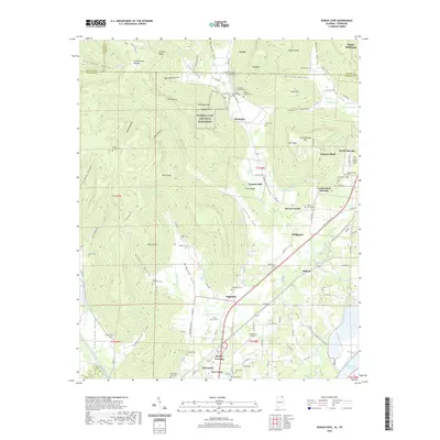
2020 Map of Doran Cove
USGS Topo · Published 2020About this map
Russell Cave National Monument anchors the upper reaches of the Doran Cove valley, where the steep escarpments of the Cumberland Plateau meet the alluvial plains of the Tennessee River basin. The landscape is defined by its karst topography, with numerous natural springs and caves including Wynne Cave Spring, Cloud Spring, and the prominent Russell Point. This 2020 survey reveals a high density of ancestral burial grounds, such as the Ridley Family Cem and Dorans Cove Cem, which suggest deep-rooted family ties to the land in the areas surrounding Montague and Edgefield. To the south, the terrain transitions into the transportation corridors of the John T Reid Pkwy, connecting the historic town centers of Bridgeport and Stevenson near the northern reaches of Guntersville Lake. The map details the complex drainage patterns of Widows Creek and Crow Creek, which have historically dictated the placement of roads and settlements throughout the county.
Find a feature on this map
148 named features on this map. Tap any name to fly to it.
Don’t see what you’re looking for? This feature index may not catch every label — zoom into the map to look around manually.
Map Details
Editions of this 2020 Doran Cove Map
This is the sole edition of this map. No revisions or reprints were ever made.
Other maps of this area

1886 · Stevenson
USGS Topo · 1:125,000

1892 · Stevenson
USGS Topo · 1:125,000

1895 · Stevenson
USGS Topo · 1:125,000

1895 · Sewanee
USGS Topo · 1:125,000

1936 · Orme
USGS Topo · 1:24,000

1936 · Bridgeport
USGS Topo · 1:24,000

1936 · Wannville
USGS Topo · 1:24,000

1936 · Flat Rock
USGS Topo · 1:24,000

1936 · Sinking Cove
USGS Topo · 1:24,000

1936 · Stevenson
USGS Topo · 1:24,000