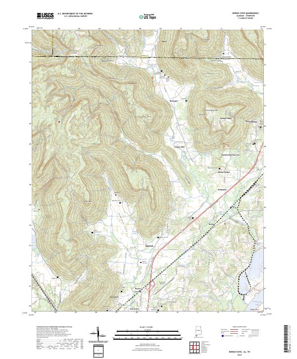
2024 Map of Doran Cove
USGS Topo · Published 2024About this map
Russell Cave National Monument anchors this corner of the Cumberland Plateau where the Alabama and Tennessee state line crosses a complex landscape of hollows and coves. The rugged geography is defined by steep ridges like Montague Mtn and Summerhouse Mtn, which separate deep recesses such as Jeffries Cove and McMahan Cove. Settlement patterns follow the lower elevations and water sources, with small communities like Orme and Mount Carmel positioned near the transitions from plateau to valley floor.
Find a feature on this map
141 named features on this map. Tap any name to fly to it.
Don’t see what you’re looking for? This feature index may not catch every label — zoom into the map to look around manually.
Map Details
Editions of this 2024 Doran Cove Map
This is the sole edition of this map. No revisions or reprints were ever made.
Other maps of this area

1886 · Stevenson
USGS Topo · 1:125,000

1892 · Stevenson
USGS Topo · 1:125,000

1895 · Stevenson
USGS Topo · 1:125,000

1895 · Sewanee
USGS Topo · 1:125,000

1936 · Orme
USGS Topo · 1:24,000

1936 · Bridgeport
USGS Topo · 1:24,000

1936 · Wannville
USGS Topo · 1:24,000

1936 · Flat Rock
USGS Topo · 1:24,000

1936 · Sinking Cove
USGS Topo · 1:24,000

1936 · Stevenson
USGS Topo · 1:24,000