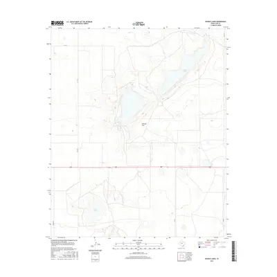
2016 Map of Double Lakes
USGS Topo · Published 2016About this map
Double Lakes and the expansive Antelope Flats dominate this part of Lynn County, showing a landscape defined by its distinctive depressions and ephemeral water bodies. The terrain is a clear example of the High Plains geology, where seasonal basins like Twin Lakes and Stud Duck Tank provide the primary relief in an otherwise level expanse. Human activity is marked by a precise grid of rural roads and state highways, including FM 1328 and FM 3112, which facilitate movement between scattered agricultural holdings. The area's hydrology, characterized by internal drainage into these named lakes, illustrates the unique water management challenges and natural catchments inherent to this portion of the Texas Panhandle region.
Find a feature on this map
10 named features on this map. Tap any name to fly to it.
Don’t see what you’re looking for? This feature index may not catch every label — zoom into the map to look around manually.
Map Details
Editions of this 2016 Double Lakes Map
This is the sole edition of this map. No revisions or reprints were ever made.
Other maps of this area

1954 · Lubbock
USGS Topo · 1:250,000

1954 · Brownfield
USGS Topo · 1:250,000

1957 · New Home
USGS Topo · 1:62,500

1957 · Meadow
USGS Topo · 1:62,500

1958 · Brownfield
USGS Topo · 1:250,000

1962 · Brownfield
USGS Topo · 1:250,000

1969 · Mound Lake
USGS Topo · 1:24,000

1969 · Skeen Lake
USGS Topo · 1:24,000

1969 · New Moore
USGS Topo · 1:24,000

1969 · Tahoka
USGS Topo · 1:24,000