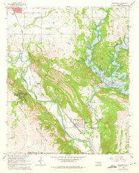
1965 Map of Dougherty
USGS Topo · Published 1975About this map
The Washita River carves a deep path through the Arbuckle Mountains during the mid-1960s, a period of significant landscape transformation for Murray County. A prominent feature of this era is the Arbuckle Dam (Under Constr) on Rock Creek, marking the creation of the Lake of the Arbuckles. This development altered the local geography near Dougherty, where the Atchison Topeka and Santa Fe railroad runs parallel to the river. The map documents the region's industrial and social fabric, from the Vines Oil Field and numerous limestone quarries to the Falls Creek Assembly grounds. Local history is preserved through the locations of the James Cem, Indian Cem, and Price Cem, alongside the remnants of an Old RR Grade that speaks to earlier transportation networks.
Find a feature on this map
41 named features on this map. Tap any name to fly to it.
Don’t see what you’re looking for? This feature index may not catch every label — zoom into the map to look around manually.
Map Details
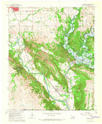
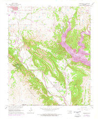
Editions of this 1965 Dougherty Map
3 editions found
Other maps of this area

1898 · Pauls Valley
USGS Topo · 1:125,000

1901 · Stonewall
USGS Topo · 1:125,000

1901 · Tishomingo
USGS Topo · 1:125,000

1901 · Ardmore
USGS Topo · 1:125,000

1902 · Pauls Valley
USGS Topo · 1:125,000

1918 · Ardmore
USGS Topo · 1:125,000

1957 · Ardmore
USGS Topo · 1:250,000

1963 · Ardmore
USGS Topo · 1:250,000

1963 · Sulphur South
USGS Topo · 1:24,000

1963 · Nebo
USGS Topo · 1:24,000