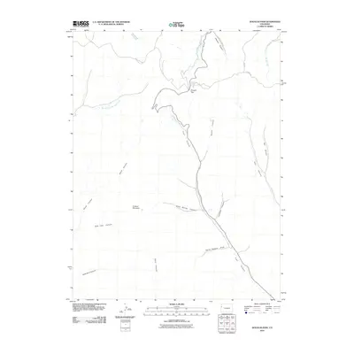
2010 Map of Douglas Pass
USGS Topo · Published 2010About this map
Douglas Pass serves as the central focal point of this Garfield County landscape, where the high terrain of the Roan Plateau drops into a complex network of drainages. The topography is defined by deep incisions such as Sawmill Canyon and Sayles Canyon, which channel seasonal water toward the West Douglas Creek and East Branch West Creek. This 2010 survey illustrates the remote transportation corridors that follow these natural contours, including West Creek Rd and the high-elevation 4 A Ridge Rd. To the south and west, the map documents significant named landforms like Lookout Mountain and the steep descents of Wild Cow Canyon and Hells Hole Canyon. The labeling of features like Horse Pasture Draw and Bitter Spring Canyon reflects the long-standing ranching and surveying history of this corner of Western Colorado.
Find a feature on this map
22 named features on this map. Tap any name to fly to it.
Don’t see what you’re looking for? This feature index may not catch every label — zoom into the map to look around manually.
Map Details
Editions of this 2010 Douglas Pass Map
This is the sole edition of this map. No revisions or reprints were ever made.
Other maps of this area

1956 · Grand Junction
USGS Topo · 1:250,000

1959 · Grand Junction
USGS Topo · 1:250,000

1960 · Grand Junction
USGS Topo · 1:250,000

1962 · Grand Junction
USGS Topo · 1:250,000

1964 · Grand Junction
USGS Topo · 1:250,000

1964 · Douglas Pass
USGS Topo · 1:24,000

1964 · Brushy Point
USGS Topo · 1:24,000

1964 · East Evacuation Creek
USGS Topo · 1:24,000

1964 · Baxter Pass
USGS Topo · 1:24,000

1964 · Calf Canyon
USGS Topo · 1:24,000