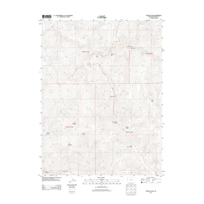
2013 Map of Douglas Pass
USGS Topo · Published 2013About this map
Douglas Pass serves as the central topographic focal point in this 2013 Garfield County landscape, where the Co-139 highway winds through complex relief to bridge the divide between distinct drainage systems. To the north, the headwaters of West Douglas Creek and its tributary East Branch West Salt Creek carve into the high plateaus, while the southern slopes are defined by a network of steep-walled ravines including Sayles Canyon, Compton Canyon, and Hells Hole Canyon.
Find a feature on this map
24 named features on this map. Tap any name to fly to it.
Don’t see what you’re looking for? This feature index may not catch every label — zoom into the map to look around manually.
Map Details
Editions of this 2013 Douglas Pass Map
This is the sole edition of this map. No revisions or reprints were ever made.
Other maps of this area

1956 · Grand Junction
USGS Topo · 1:250,000

1959 · Grand Junction
USGS Topo · 1:250,000

1960 · Grand Junction
USGS Topo · 1:250,000

1962 · Grand Junction
USGS Topo · 1:250,000

1964 · Grand Junction
USGS Topo · 1:250,000

1964 · Douglas Pass
USGS Topo · 1:24,000

1964 · Brushy Point
USGS Topo · 1:24,000

1964 · East Evacuation Creek
USGS Topo · 1:24,000

1964 · Baxter Pass
USGS Topo · 1:24,000

1964 · Calf Canyon
USGS Topo · 1:24,000