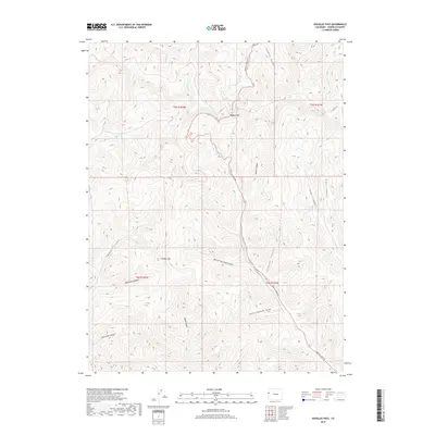
2019 Map of Douglas Pass
USGS Topo · Published 2019About this map
Douglas Pass serves as the focal point of this high-altitude Garfield County survey, where the winding route of Douglas Pass Rd navigates the divide between the W Douglas Cr and E Br W Salt Cr drainages. The landscape is defined by a dense network of deeply etched drainages, including Bitter Spring Canyon and Wild Cow Canyon, which illustrate the complex erosion patterns of the western slope. Notable landmarks like Lookout Mtn and the evocatively named Hells Hole Canyon provide fixed points of reference for navigating this labyrinthine terrain. The presence of Ford Spring near the pass highlights a critical water source in an otherwise arid and high-relief environment, while secondary routes like Co Hwy 256 link the remote canyon systems of Edd Canyon and Brush Cr to the primary mountain thoroughfare.
Find a feature on this map
24 named features on this map. Tap any name to fly to it.
Don’t see what you’re looking for? This feature index may not catch every label — zoom into the map to look around manually.
Map Details
Editions of this 2019 Douglas Pass Map
This is the sole edition of this map. No revisions or reprints were ever made.
Other maps of this area

1956 · Grand Junction
USGS Topo · 1:250,000

1959 · Grand Junction
USGS Topo · 1:250,000

1960 · Grand Junction
USGS Topo · 1:250,000

1962 · Grand Junction
USGS Topo · 1:250,000

1964 · Grand Junction
USGS Topo · 1:250,000

1964 · Douglas Pass
USGS Topo · 1:24,000

1964 · Brushy Point
USGS Topo · 1:24,000

1964 · East Evacuation Creek
USGS Topo · 1:24,000

1964 · Baxter Pass
USGS Topo · 1:24,000

1964 · Calf Canyon
USGS Topo · 1:24,000