
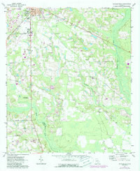
1971 Map of Douglas South
USGS Topo · Published 1974About this map
The southern outskirts of Douglas expand into the coastal plain in this early 1970s survey, anchored by institutional landmarks like South Georgia College and the Douglas Municipal Airport. The landscape is a transition from the structured street grid of the city to the meandering swampy corridors of the Satilla River and Seventeen Mile River. A network of country churches and family-named burial grounds, including Wayfarer Ch, Franklin Ch, and McClelland Cem, provides a detailed record for genealogists tracing families in the southern portion of Coffee and Atkinson counties.
Find a feature on this map
32 named features on this map. Tap any name to fly to it.
Don’t see what you’re looking for? This feature index may not catch every label — zoom into the map to look around manually.
Map Details
Editions of this 1971 Douglas South Map
2 editions found
Other maps of this area

1953 · Waycross
USGS Topo · 1:250,000

1958 · Waycross
USGS Topo · 1:250,000

1971 · Douglas North
USGS Topo · 1:24,000

1971 · Nicholls
USGS Topo · 1:24,000

1971 · Wilsonville
USGS Topo · 1:24,000

1971 · Axson
USGS Topo · 1:24,000

1971 · Pearson
USGS Topo · 1:24,000

1972 · Kirkland
USGS Topo · 1:24,000

1972 · Mora
USGS Topo · 1:24,000
1977 · Mora
USGS Topo · 1:24,000