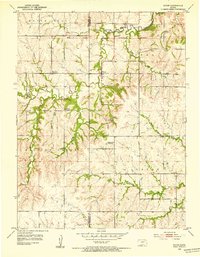
1952 Map of Dover
USGS Topo · Published 1953About this map
Dover sits at the heart of this landscape where the Wabaunsee Co Shawnee Co line divides the rolling hills of northeast Kansas. The area is defined by the winding course of Mission Creek and the Middle Branch Wakarusa River, which carve through the terrain and cross the South Boundary Old Potawatomi Reservation. This mid-century survey reveals a rural landscape in transition, noting several educational landmarks as defunct, such as School No 5 (Abandoned) and Highland Sch (Abandoned). These labels, alongside the Girl Scout Camp and established burial grounds like Dover Cem and St Bartholomew Cem, provide concrete evidence of shifting population centers and community life. The intricate network of small tributaries including Loomis Creek and Massasoit Creek illustrates the complex drainage system feeding into the larger Wakarusa River basin, reflecting the agricultural dependence on these local water sources.
Find a feature on this map
20 named features on this map. Tap any name to fly to it.
Don’t see what you’re looking for? This feature index may not catch every label — zoom into the map to look around manually.
Map Details
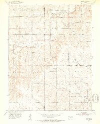
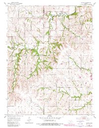
Editions of this 1952 Dover Map
3 editions found
Other maps of this area

1885 · Eskridge
USGS Topo · 1:125,000

1889 · Burlingame
USGS Topo · 1:125,000

1889 · Wamego
USGS Topo · 1:125,000

1889 · Eskridge
USGS Topo · 1:125,000

1889 · Topeka
USGS Topo · 1:125,000

1894 · Eskridge
USGS Topo · 1:125,000

1894 · Burlingame
USGS Topo · 1:125,000

1894 · Topeka
USGS Topo · 1:125,000

1894 · Wamego
USGS Topo · 1:125,000

1947 · Lawrence
USGS Topo · 1:250,000