
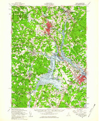
1956 Map of Dover
USGS Topo · Published 1960About this map
The Piscataqua River and Great Bay anchor this 1950s study of the New Hampshire coast, documenting a landscape at the height of its mid-century military and industrial transition. The establishment of Pease Air Force Base dominates the southern reaches, marking a significant shift in land use near Newington and Portsmouth. Farther inland, the academic campus of the University of New Hampshire stands in Durham, while the Boston and Maine Railroad continues to thread through traditional manufacturing and transit centers like Dover, Sawyers, and Salmon Falls.
Find a feature on this map
208 named features on this map. Tap any name to fly to it.
Don’t see what you’re looking for? This feature index may not catch every label — zoom into the map to look around manually.
Map Details
Editions of this 1956 Dover Map
4 editions found
Other maps of this area

1888 · Newburyport
USGS Topo · 1:62,500

1888 · Haverhill
USGS Topo · 1:62,500

1890 · Haverhill
USGS Topo · 1:62,500

1890 · Newburyport
USGS Topo · 1:62,500

1891 · Berwick
USGS Topo · 1:62,500

1891 · Kennebunk
USGS Topo · 1:62,500

1893 · Kennebunk
USGS Topo · 1:62,500

1893 · Dover
USGS Topo · 1:62,500

1893 · Berwick
USGS Topo · 1:62,500

1893 · York
USGS Topo · 1:62,500