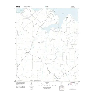
2012 Map of Downsville North
USGS Topo · Published 2012About this map
Bayou D'Arbonne Lake dominates the northern reaches of this Union Parish landscape, its irregular shoreline creating a complex geography of points and inlets. The 2012 topography reflects a region shaped by both its hydraulic features and its energy resources, notably the Bayou D'Arbonne Gas Field and Stowe Creek Gas Field which dot the terrain between watercourses like Stowe Cr and Cypress Cr.
Find a feature on this map
102 named features on this map. Tap any name to fly to it.
Don’t see what you’re looking for? This feature index may not catch every label — zoom into the map to look around manually.
Map Details
Editions of this 2012 Downsville North Map
This is the sole edition of this map. No revisions or reprints were ever made.
Other maps of this area

1950 · Ruston
USGS Topo · 1:62,500

1951 · Ruston
USGS Topo · 1:62,500

1951 · Bernice
USGS Topo · 1:62,500

1952 · Calhoun
USGS Topo · 1:62,500

1952 · Farmerville
USGS Topo · 1:62,500

1955 · Shreveport
USGS Topo · 1:250,000

1956 · Shreveport
USGS Topo · 1:250,000
1982 · Calhoun
USGS Topo · 1:24,000
1982 · Point
USGS Topo · 1:24,000
1982 · Downsville North
USGS Topo · 1:24,000