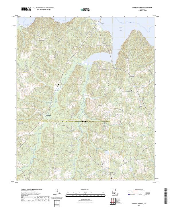
2024 Map of Downsville North
USGS Topo · Published 2024About this map
Farmerville and Downsville anchor this northern Louisiana landscape where the Union Parish Lincoln Parish line bisects the rolling terrain. The expansion of Bayou D'Arbonne Lake dominates the northern reaches, its irregular fingers reaching into the surrounding timberlands. This modern survey illustrates the current shoreline and the network of parish roads, such as Parish Rd 5543 and Cox Ferry Rd, that connect the residential developments along the water to the older inland settlements.
Find a feature on this map
90 named features on this map. Tap any name to fly to it.
Don’t see what you’re looking for? This feature index may not catch every label — zoom into the map to look around manually.
Map Details
Editions of this 2024 Downsville North Map
This is the sole edition of this map. No revisions or reprints were ever made.
Other maps of this area

1950 · Ruston
USGS Topo · 1:62,500

1951 · Ruston
USGS Topo · 1:62,500

1951 · Bernice
USGS Topo · 1:62,500

1952 · Calhoun
USGS Topo · 1:62,500

1952 · Farmerville
USGS Topo · 1:62,500

1955 · Shreveport
USGS Topo · 1:250,000

1956 · Shreveport
USGS Topo · 1:250,000
1982 · Calhoun
USGS Topo · 1:24,000
1982 · Point
USGS Topo · 1:24,000
1982 · Downsville North
USGS Topo · 1:24,000