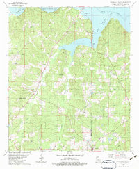
1982 Map of Downsville North
USGS Topo · Published 1983About this map
Bayou D'Arbonne Lake dominates the northern horizon of this North Louisiana landscape, where the waters of Stowe Creek and Cypress Creek feed into the reservoir's expansive reach. Mapping the border between Union Parish and Lincoln Parish, the survey reveals a rural economy shaped by natural resource extraction and agriculture, evidenced by numerous Gas Wells and Drill Holes scattered across the wooded hills. The settlement of Downsville sits at the southern edge, serving as a hub for the surrounding countryside. Deeply rooted local history is preserved in the distribution of community landmarks, from the D'Arbonne Lookout Tower to several country congregations like Woodlawn Ch and Mt Nebo Ch. Genealogists will find particular value in the identification of family-named burial sites such as Feazel Cem and the Holmesville Ch Cem, which anchor the map to its long-standing residents.
Find a feature on this map
26 named features on this map. Tap any name to fly to it.
Don’t see what you’re looking for? This feature index may not catch every label — zoom into the map to look around manually.
Map Details
Editions of this 1982 Downsville North Map
This is the sole edition of this map. No revisions or reprints were ever made.
Other maps of this area

1950 · Ruston
USGS Topo · 1:62,500

1951 · Ruston
USGS Topo · 1:62,500

1951 · Bernice
USGS Topo · 1:62,500

1952 · Calhoun
USGS Topo · 1:62,500

1952 · Farmerville
USGS Topo · 1:62,500

1955 · Shreveport
USGS Topo · 1:250,000

1956 · Shreveport
USGS Topo · 1:250,000
1982 · Calhoun
USGS Topo · 1:24,000
1982 · Point
USGS Topo · 1:24,000
1982 · Downsville South
USGS Topo · 1:24,000