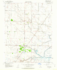
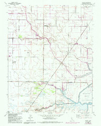
1952 Map of Dozier
USGS Topo · Published 1963About this map
Binghamton and Bunker anchor the northern landscape of this agricultural region in Solano County, where a complex network of sloughs and irrigation channels defines the delta terrain. The Sacramento Northern railroad cuts through the center of the sheet, providing a vital transport link for small settlements like Dozier and Olcott. This mid-century survey captures the area’s dependence on water management, evidenced by the extensive Levee systems and the presence of the Hastings Tract.
Find a feature on this map
28 named features on this map. Tap any name to fly to it.
Don’t see what you’re looking for? This feature index may not catch every label — zoom into the map to look around manually.
Map Details
Editions of this 1952 Dozier Map
5 editions found
Other maps of this area

1907 · Antioch
USGS Topo · 1:62,500

1908 · Vacaville
USGS Topo · 1:62,500

1908 · Courtland
USGS Topo · 1:62,500

1908 · Antioch
USGS Topo · 1:62,500

1910 · Rio Vista
USGS Topo · 1:31,680

1916 · Dixon
USGS Topo · 1:31,680

1916 · Cache Slough
USGS Topo · 1:31,680

1916 · Maine Prairie
USGS Topo · 1:31,680
1916 · Saxon
USGS Topo · 1:31,680

1917 · Wolfskill
USGS Topo · 1:31,680